Explore...
- Travel services
- Things to do
- Travel Assistant
- Community Activities & Events
Profile
- Sign in
 Register
- Download Tatinta App
 Sign in Travel Agent
 Sign in Supplier
 Sign in Affiliate
 Sign in Guru


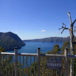
 Kiyosato, Shari District, Hokkaido 088-3461, Nhật Bản
On the left side of the observatory (southeast of the lake) is the volcano Camuinupri (Mt. Mashu) which means "Mountain of God". Lake Mashuko is a crater lake formed by the collapse of the Mashu volcano, and you can see traces of volcanic activity from the terrain surrounded by the surrounding raised crater walls.
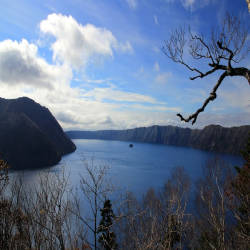
Mashu Volcano was formed at the site of present-day Lake Mashuko about 10,000 years ago and repeated large eruptions. The largest eruption occurred 7,000 years ago and a large amount of volcanic ash and pyroclastic flows were ejected. After 3,000 years, water accumulated in the crater and Lake Mashuko was formed but it was larger than today, the largest eruption occurred in Camuinupuri about 1,000 years ago, which destroyed its mountain top and the lake's size size like now.
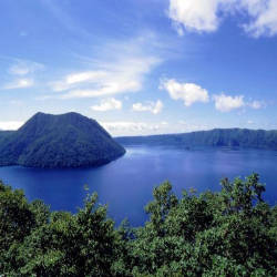
Kamuish Island is a small island, located in the center of the lake, but this is actually a lava dome about 230m long below the water surface and about 1km in diameter at the bottom.
The observatory is closed during the winter, and can only be visited between April and November.
Entrance fee: free
Hours of Operation: All day