
See all results for ""

 Tiếng ViệtEnglish
 한국어
한국어 日本語
日本語 简体中文
简体中文 Français
 Deutsch
 Español
 Italiano
 Русский


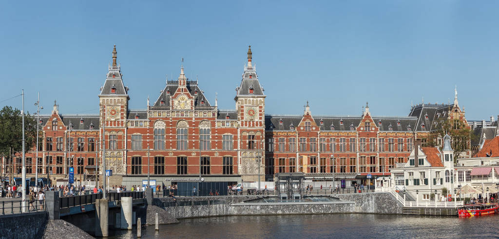
Prins Hendrikkade (Central Station West)
 Prins Hendrikkade, Amsterdam, Netherlands
Prins Hendrikkade (Dutch for "Prince Henry's Harbor") is a major street in the center of Amsterdam.
Prins Hendrikkade passes through Amsterdam Central Station, intersects with Damrak at the mouth of the Amstel River, and forms the southern end of the IJ Tunnel across IJ bay. The street formed the northern edge and outer harbor of the city until the 19th century. It was named after Prince Henry of the Netherlands, the youngest son of King William II, after Henry's death in 1879. .
The Prins Hendrikkade runs roughly northwest to southeast, from the northern end of the Singel Canal to Kattenburgerplein. Cars are banned from the roadway in front of Amsterdam Central Station, between Martelaarsgracht and Damrak. The street continues to the west are Nieuwe Westerdokstraat and Haarlemmerhouttuinen. At the east end, the street turns north at Kattenburgerplein and continues on to Kattenburgerstraat. The body of water between Prins Hendrikkade and the train station is known as the Open Havenfront and further east, is Oosterdok.
Along the street are 99 buildings that have been listed as national monuments (rijksmonuments). Prominent buildings on the street include the Basilica of Saint Nicholas, the Schreierstoren, the Scheepvaarthuis, and the Victoria Hotel. Along the eastern part of the street are a number of docks where houseboats dock.
Amsterdam Central Station, the city's main train station, is located just north of the street. The Amsterdam Metro's Amsterdam Central Stop has an entrance on Prins Hendrikkade, just east of Saint Nicholas Cathedral. Some bus lines also stop at Prins Hendrikkade. Tram lines 4 and 14 pass through part of Prins Hendrikkade between Amsterdam Central Station and Dam Square, but do not stop en route.